death valley california The National Park Service recently announced that it will no longer paddle in the continent’s driest place because a lake that emerged in Death Valley is disappearing, but NASA has released satellite images that show just how big the so-called ghost lake really is.
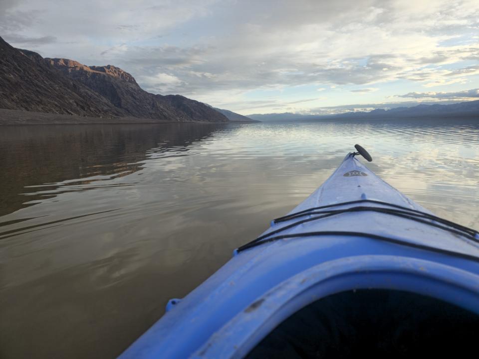
Death Valley National Park averages just 2 inches of rainfall per year and 130 inches of evaporation, but it has been a paddling mecca for outback kayakers since the summer when a lake reappeared after being extinct for 10,000 years .
Chilling irony: World heat champion Death Valley is named partly after a snowstorm
The lake known as “Lake Manly” began to develop during Hurricane Hillary. This giant Category 4 storm hit Mexico in August 2023 and continued into California. The National Hurricane Center issued a tropical storm warning for Southern California for the first time. In just one day, more than a year’s worth of rain fell. Floodwaters rushed into nearly every basin in the national park.
After Hurricane Hillary, Death Valley National Park became a land of ephemeral lakes
“The one that stands out the most is the one in Badwater Basin,” Death Valley National Park ranger Matthew Lamar told Fox Weather in November.
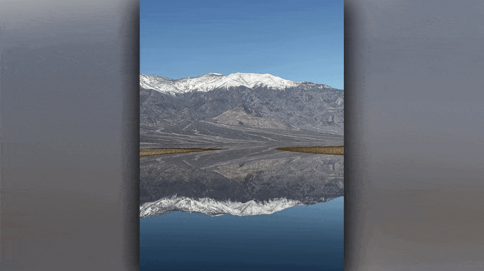
Lamar said Badwater Basin is a salt flat located 282 feet below sea level, stretching as far as the eye can see and is the lowest point in North America. He said it was filled with 2 feet of water after the storm, but because the area is typically desert, there are no permanent instruments to measure the depth. Rangers and park visitors judge depth by wading in the water.
Death Valley reopens 195 miles of roads damaged by Hurricane Hillary
By November, the lake had dropped to a few inches, he said. Then came the winter arrival of 51 atmospheric rivers, flooding the West Coast. After February’s rainfall dropped three-quarters of a year’s worth in one day, the kayakers set sail again.
Death Valley National Park’s atmospheric river snows, floods roads
NASA measured the depth of the ephemeral lake using the U.S.-French Surface Water and Ocean Topography satellites. Over a six-week period, from February 2 to March 4, the water depth varied from 3 feet to 1.5 feet. Analysts used satellites to measure the water’s elevation and combined it with U.S. Geological Survey data about the basin.
NASA images tell the story of a stormy February and a windy March.
Kayaking halted in Death Valley due to strong winds blowing to temporary lake 2 miles north
“The researchers found that during the roughly 10 days between SWOT observations, water levels varied across space and time. After a series of storms in early February, the temporary lake was approximately 6 miles (10 kilometers) long and 3 meters wide. Miles (3 miles). “Each pixel in the image represents an area of approximately 330 feet by 330 feet (100 meters by 100 meters). “
Another storm brought strong winds to Death Valley between February 29 and March 4. Kayaking activities were temporarily suspended at that time. On Sunday, the park closed the “lake” to boating.
How to watch Fox Weather
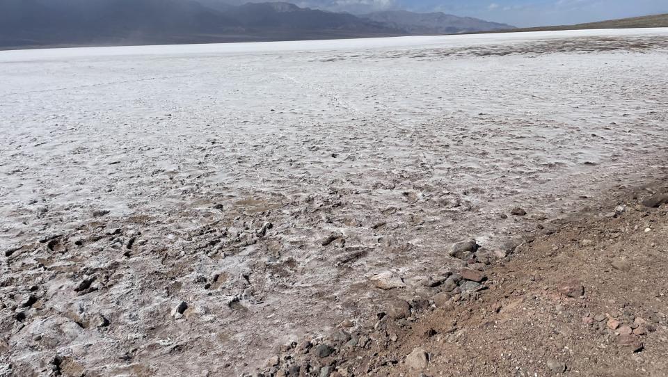
“‘Lake Manley’ is a temporary shallow lake in Badwater Basin (formed after storms in August 2023 and February 2024) that is rapidly shrinking and is now only a few inches deep. It is at least 1/4 mile from the road. Rough , uneven salt and mud (no trace),” the NPS release said. “Due to the shallow water of the lake and the damage caused by people dragging boats across the salt flats, the lake is closed to all boating activities (kayaks, paddleboards, canoes, pool buoys, etc.).”
However, visitors can still walk in the water and admire the reflection of the mountain scenery. However, park officials prohibit anyone from walking in the mud and leaving footprints, which will scar the landscape until the next severe weather event causes the lake to reappear.
Original source of the article: NASA satellite shows how big Death Valley’s Ghost Lake is
#NASA #satellite #shows #big #Death #Valleys #Ghost #Lake
Image Source : www.yahoo.com