Environmental assessment responses will be accepted by January 16
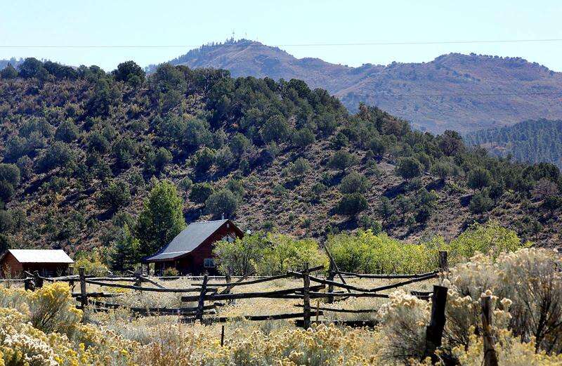
The HD Mountains east of Bayfield are important habitat for elk and deer and are home to many Native American cultural sites. The Forest Service has released a draft environmental assessment for a proposed drilling and pipeline project southeast of Bayfield. (Jerry McBride/Durango Herald files)

The San Juan National Forest is accepting comments on a draft environmental assessment for a controversial natural gas drilling and pipeline project in the HD Mountains southeast of Bayfield.
Catmount Energy Partners is behind the development, which will expand the company’s infrastructure in the area.
Forest’s preferred action is to drill seven horizontal wells from the existing well pad, which would disturb 1.6 acres of the previously disturbed 1.9 acres. It will also involve the construction of 8.4 miles of pipeline, much of which will be laid along forest roads. Only half a mile of the pipeline will cross undisturbed areas, and the entire project will result in 3.55 acres of long-term disturbance.
The well pad in question crosses the county line just into Archuleta County, and the pipeline will be extended back to La Plata County.
By drilling horizontal wells, Catamount can tap 6.25 square miles of coalbed methane reservoirs, a type of natural gas, beneath the HD Mountains. The area is located in the northern part of the San Juan Basin, which has long been affected by fossil fuel extraction. Catamount has about 40 active wells in Archuleta and La Plata counties.
The company holds rights to these minerals through the Bureau of Land Management. However, development must obtain a permit from the Forest Service, which manages surface impacts.
The construction of natural gas extraction infrastructure has sparked fierce opposition from local residents who express concerns about deer and elk herds, historic cultural resources and other environmental impacts.
The environmental assessment describes the proposed actions as a vast improvement over the impacts foreseen when the forest plan was finalized in 2013. At the time, the project was considered a reasonably foreseeable development and was analyzed in the final environmental impact statement. The plan is expected to require 50 well pads instead of one and disturb 115 acres instead of 3.55 acres.
The project will involve the construction of the Spring Creek Archaeological Area. The site contains artifacts and evidence of Aboriginal habitation dating back to 300 BC. The SJNF solicited input from 25 tribes and Pueblos, resulting in a memorandum of agreement signed between the Forest Service and Colorado historic preservation officials.
Therefore, archaeologists and tribal representatives will oversee the excavation through historical heritage and other regulations.
As public lands project manager for the San Juan Citizens Alliance, John Rader serves as an expert monitor, ensuring that proposals like the Spring Creek pipeline project comply with federal law.

The San Juan National Forest has released a draft environmental assessment for the Catamount Spring Creek pipeline and related Fruitland gas drilling project. The project will primarily include the construction of an 8.4-mile red pipeline along existing roads and the expansion of the well pad labeled PARGIN MTN UT 2. (Courtesy San Juan National Forest)

He said the Forest Service has done a good job in some areas, particularly with the Southern Ute Indian Tribe, focusing on avoiding cultural resources and working to minimize new surface disturbances.
The main risks we see are steep, loose soils in landslide-prone areas, impacts on elk’s winter range and risks to water resources, he said.
Rader said the North San Juan Basin Coalbed Methane Project EIS considers impacts to elk’s winter range, and the document lays out some mitigation measures.
Longtime Bayfield resident David Honea, who has been involved in previous efforts to mitigate the impacts of oil and gas extraction, said he hasn’t had a chance to read the new assessment report. However, he said the Dec. 15 release, which corresponds to the 30-day comment period ending Jan. 16, was unfortunate because most people didn’t have time to review the document during the holidays.
The draft environmental assessment can be found on the project webpage at fs.usda.gov/project/?project=63036 or at the Columbine Ranger District Office. Comments will be a matter of public record and can be submitted online or in writing to the Columbine District Ranger, PO Box 439, 367 Pearl Street Bayfield, CO 81122, by January 16.
rschafir@durangoherald.com
#Mountains #Drill #Program #Accepts #Comments
Image Source : www.durangoherald.com